scuba.lu Home
login
  News | Events & Expeditions | Dive Sites | Reports | Download | Links

Dive Sites in Luxembourg
  ·
Haute Sûre
  ·
Haute Sûre - Maps


Diving on the ruins Nature dives New topo map 1954 topo map

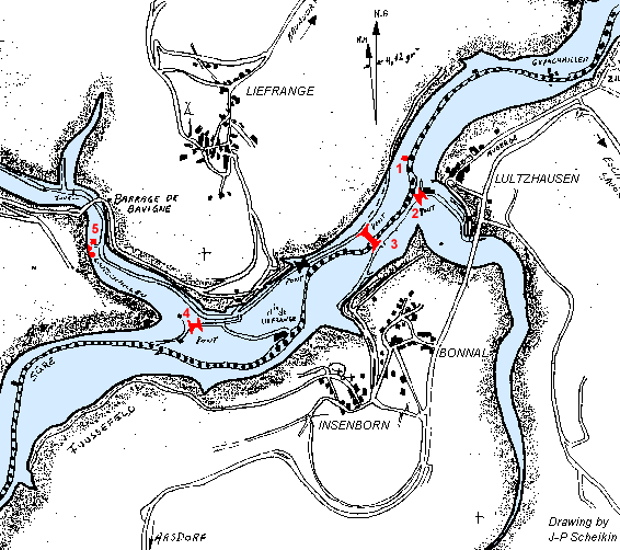
The map shows the locations of Lultzhausen. Bonnal, Insenborn and Liefrange. The old river-bed is marked by a large pointed line. Squares are for ruins, mostly old mills. "Pont" stands for stone bridge. Clickable areas are marked in red color.

Map of the Lake Stone bridge of Bonnal Ruins of Liefrange Stone bridge of Liefrange Ruin of Lultzhausen Stone bridge of Lultzhausen
More:
Maps & GPS Data: see Download

  © 2000-2024 by Jerome Konen. All rights reserved. search · newsletter · contact · disclaimer